Verified View Survey
Precise Imagery for Planning Submissions
Get a Free Quote From Us Today!
We aim to get back to you in 24 hours.
At Verified View Survey, we specialise in providing comprehensive surveying and photography services to produce verified views and Accurate Visual Representations (AVR). Our expertise ensures that camera positions and site data are precisely captured.
This allows us to showcase proposed developments within existing environments accurately. Serving clients across the UK, we deliver precise visualisations tailored for urban planning, landscaping projects, and architectural firms.
Who Is Verified View Survey?
We at Verified View Survey are dedicated to producing verified views and Accurate Visual Representations through expert surveying and photography. Our process involves meticulous site analysis and the use of equipment like total stations to accurately capture the positions of camera viewpoints and key reference points.
We ensure the depictions align with developments in real-world landscapes by integrating GIS data and drone technology for comprehensive site imaging.
Our clients include urban planners, architects, and landscapers who require precision and reliability. We also adhere to the industry’s stringent guidelines for visualisation, such as those set by the Landscape Institute, to provide assurances of accuracy.
By translating technical data into impactful visual results, we help our clients visualise their projects’ future impact efficiently. For top-tier visual accuracy in your project, contact us today.
What Services Does the company Verified View Survey Provide?
At Verified View Survey, we offer a range of services to meet your requirements:
- Verified View Surveys: We capture accurate data for seamless integration of proposed developments into existing views. Our surveys comply with industry standards like the Landscape Institute Guidance and are vital for planning applications and environmental impact assessments.
- Camera Location Mapping: Pinpoint precise camera positions for reliable visualisation, using GPS/GNSS equipment and laser rangefinders. This ensures our visualisations align precisely with the actual locations for trustworthy renderings.
- Site Data Collection: We obtain detailed site measurements, such as elevation and terrain data, using total stations and LiDAR technology to facilitate accurate representation of topographical features.
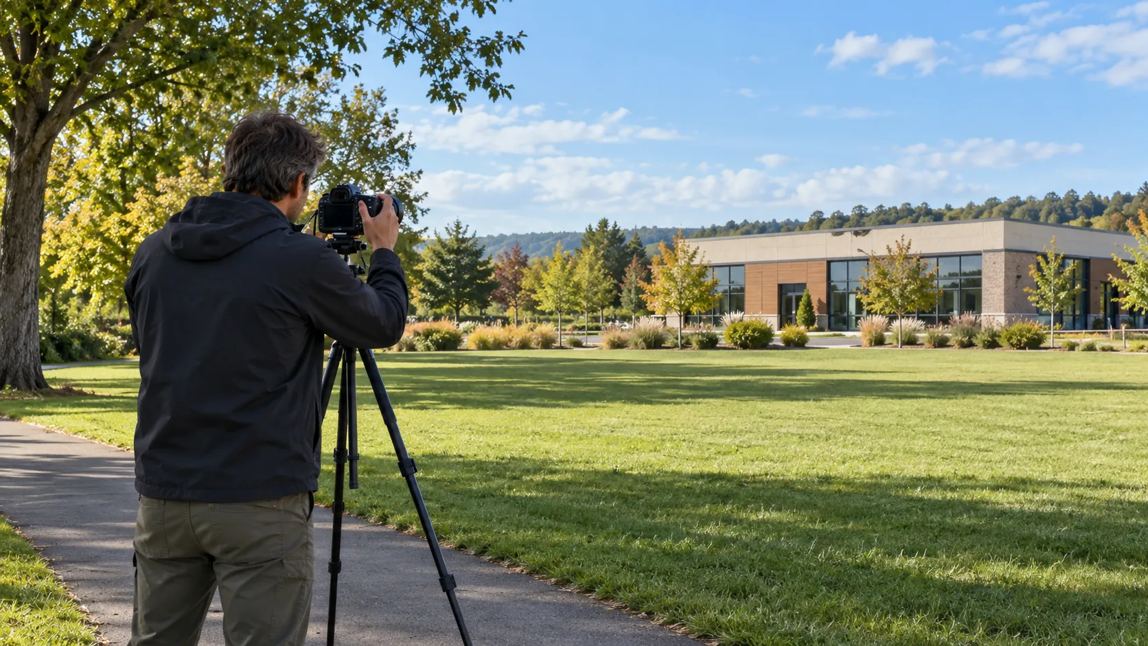
- Photographic Documentation: We provide high-quality images essential for clear project visualisations. Using high-resolution cameras with calibrated lenses, our images support virtual tours and augmented reality applications, enhancing presentation and stakeholder engagement.
Contact us today to discuss how we can support your project needs.
When Is Surveying Needed?
Surveying from Verified View Survey is needed when urban planners, architects, or developers require precise visual representations of proposed projects within current environments. Our detailed topographic surveys, capturing existing terrain features, are essential for site analysis and design optimisation.
Prior to planning applications or community consultations, our services ensure accurate and reliable depictions, helping stakeholders make informed decisions.
We employ photogrammetry and LiDAR scanning to capture detailed 3D models and maps, facilitating virtual walks through planned developments. These techniques are vital for understanding how new buildings will interact with the natural light and surrounding structures in real time.
Surveys are also critical in boundary demarcation, addressing issues of property disputes by confirming legal property lines. With the use of GPS technology, our team can quickly and accurately map out land features.
Contact us today to discuss your surveying requirements.
Get a Free No Obligation Quotation Today
How Does Verified View Survey Work?
We employ a systematic approach to guarantee reliable results, ensuring we meet the specific needs of each client.
- Initial Consultation: Discuss project requirements and objectives, defining key metrics such as the Level of Detail (LoD) needed for visualisations and expected project timelines. We adapt our methods to suit differing client types, whether architects, developers, or local councils.
- Site Visit: Conduct an on-site assessment to gather essential data, using tools like total stations and drones for accurate topographical surveys. Compliance with guidelines such as the Landscape Institute’s requirements ensures our assessments meet industry standards.
- Data Analysis: Process the collected information for precision, employing Geographic Information System (GIS) software and Computer-Aided Design (CAD) tools to create precise 3D models and simulate environmental impacts.
- Report Generation: Create detailed visual and written reports for client review, including Verified Views, overlaying proposed developments onto high-resolution photographs for an accurate representation. This allows our clients to make informed decisions and obtain necessary approvals efficiently.
Who Does Verified View Survey Help?
At Verified View Survey, we assist a variety of clients including architects, urban planners, and landscape designers. Our services are beneficial to property developers and local authorities as well, as they aim to balance development needs with environmental considerations.
We provide these clients with accurate visual tools such as photomontages and computer-generated imagery (CGI), which are essential for assessing the visual impact of proposed developments. These tools simplify communication about potential changes and help to clearly convey ideas to stakeholders.
Our photomontage services adhere to Accepted Guidelines for Landscape and Visual Impact Assessment and can be tailored to meet the precise requirements of specific planning authorities. In doing so, we support projects from initial concept to approval, facilitating community engagement and increasing the likelihood of planning consent while ensuring compliance with industry standards.
Reach out to us to learn how we can support your next project.
How Quickly Can Verified View Survey Respond?
Verified View Survey typically responds to project enquiries within three to five business days, depending on the complexity and scale of the project. Our team is equipped with advanced software such as AutoCAD and 3ds Max, which allows us to efficiently manage and process visual data.
We adhere to industry standards like the Landscape Institute’s Guidelines for Visual Impact Assessment, ensuring our deliverables are both precise and compliant.
We cater to a range of client types, including architects, urban planners, and environmental consultants, providing them with crucial insights for planning applications and impact assessments. For larger projects, we aim to streamline our workflow to meet demanding deadlines without compromising on accuracy.
Contact us to discuss your project timelines and requirements.
How Does Verified View Survey Ensure Quality and Compliance?
We at Verified View Survey adhere to industry standards, employing advanced equipment and methodology to ensure accuracy in every project. Our use of high-precision total stations and GPS systems guarantees the precision necessary for detailed measurements.
These tools allow us to meet the compliance requirements set by organisations such as the Royal Institution of Chartered Surveyors (RICS) and the Survey Association.
Our rigorous data validation processes involve cross-referencing collected data with digital models to verify accuracy. We also conduct regular equipment calibrations and staff training to align with the latest industry protocols.
This thorough approach not only ensures compliance with legal standards but also enhances our client’s confidence in our service.
Our use of surveying technology provides users with reliable and trustworthy results. If you require precise surveying services, contact us today to discuss your project needs.
Request a free quote
Why Choose Verified View Survey?
Our approach makes us the trusted choice for verified views and Accurate Visual Representations (AVRs). We meticulously document and analyse each project using precise photomontage techniques and 3D modelling software, ensuring the representations meet local planning authorities’ requirements.
- Precision and Accuracy: Obtain detailed and reliable representations that adhere to the latest planning guidelines and standards.
- Industry Expertise: Benefit from a team with extensive experience and knowledge in architectural visualisation, urban planning, and landscape architecture, ensuring informed evaluations.
- Client Support: Receive attentive service tailored to your project needs, backed by responsive communication throughout the consultation and execution phases.
- Efficient Turnaround: Enjoy prompt responses and timely project delivery, typically within two to three weeks, keeping your projects on schedule.
We strive to provide you with visually compelling and compliant solutions that support decision-making and stakeholder engagement.
Frequently Asked Questions
What are verified views?
Verified views are visual representations that accurately show proposed developments within existing environments, ensuring precise integration and evaluation.
How long does a survey usually take?
A typical survey by Verified View Survey requires about one to two weeks, including data gathering, processing, and report generation.
Why are Accurate Visual Representations important?
Accurate Visual Representations help stakeholders understand how new developments will appear in context, assisting in decision-making for planning and design.
Can Verified View Survey handle large projects?
Yes, we at Verified View Survey are equipped to manage projects of varying sizes, offering services tailored to the scale and complexity of each project.
What technology do you use?
Our surveys use technology including GPS for camera mapping and high-resolution photography for supreme detail.
Get a Free Quote
Contact us at Verified View Survey to discuss your next project and receive a tailored quote for our services.
speak with our team today
What People are Saying About Us
★★★★★
“Really pleased with the whole experience, and Verified View Survey were a pleasure to work with. Would happily recommend.”
Oliver Greenwood
London
★★★★★
“We needed accurate verified views for a planning application. Verified View Survey delivered them in good time, and the planning officer accepted them without question.”
Hannah Bennett
London
★★★★★
“Verified View Survey photographed each agreed viewpoint and recorded every camera position accurately. The final images arrived in a tidy pack we could submit straight away.”
Oliver Grant
London
★★★★★
“Clean, accurate images from Verified View Survey, delivered on time. Would happily use them again.”
Marcus Rahman
London
Our Locations
We are proud to work nationally across the UK, allowing us to ensure we can provide services to you.
For a full list of counties we cover in the UK, see below.